MARYsCOMIX
  • Mary's Page
  • Airbrush Metal Stuff
  • Airbrush Projects
  • Street Art
  • Felix Projects
  • Old School Comix
  • Trip Gallery
  • Artist Infos
  • Legal Notice / IMPRESSUM
  • Right of Withdrawal
  • Data Protection
  • General terms and conditions of business
  • Blog

@ NICARAGUA @
= The Middle of America =

My Nicaragua Chronicles: 20 Years, One Heart, and Endless Dirt Roads
When people ask me how well I know Nicaragua, I usually tell them to pull up a chair and grab a cold Toña beer or in my case a Victoria. This isn’t a country I just visited for a two-week vacation; it’s a country that shaped my life, became a second home, and gave me a son who is a proud Nica.
My love affair with the land of lakes and volcanoes began way back in 2002, and over the next twenty years, I returned time and time again, completely throwing myself into its raw beauty, chaotic history, and warm-hearted people. I didn’t just travel here—I lived here
The Timeline of an Absolute Insider
To give you an idea of just how deep my roots in this country go, here is how my two-decade journey unfolded:
  • 2002 – 2004 (The Airline Nomad): Juggling my job at the airport in Germany, I spent months at a time flying back and forth to Nicaragua. This was the era of raw adventure, where I visited the isolated Rama Indians twice (in 2002 and 2003) and accidentally became the very first tourist to ever step foot in Mérida on Ometepe Island back in 2002. Trust me, there is a very special story coming up about that!
  • 2008 (The Mother-Son Road Trip): I packed up my 4-year-old son and rented a 4x4 for an epic four-month journey across the country. We even settled down for two months in a rented apartment in the beach town of San Juan del Sur, learning the slow, beautiful rhythm of coastal life.​
  • 2010 – 2011 (Living on the Edge): We took a massive leap into the unknown and moved to Bilwi (Puerto Cabezas) on the remote, wild Atlantic Coast, where we lived for 14 incredible months.
  • 2018 & 2019 (The Reunion Trips): Short but intense two-week bursts to reconnect, hug my local Nicaraguan friends, and see how the country was changing.
  • 2022 (The 8-Month Deep Dive): My most recent long-term stay. I spent two months living in Mérida, three months in the misty mountains of Matagalpa teaching English and German, and the final three months traveling to the absolute edges of the country—visiting remote regions where tourists simply do not go, or don't even know exist.
Beyond the Guidebooks
Through all these years, I have gathered endless stories, wild pannes, corrupt police encounters, and deep human connections. This section of my website is not your standard, polished TripAdvisor guide. It’s a collection of my raw, personal adventures spanning over twenty years.
So, welcome to my Nicaragua. Let's start from the very beginning...

Picture
Volcanic Trails and Ancient Empires: Nicaragua's Roots
The Great Migration and the Footprints of Acahualinca
While historians estimate that the great migration from Asia to the Americas took place around 28,000 BC, the very first nomadic tribes began filtering into what is now Nicaragua around 18,000 BC. However, if you look at the theory that parts of the population arrived across the Pacific from Polynesia, the timeline points closer to 8,000 BC.
But history isn't just about abstract dates; it’s about real people. Right in the heart of modern-day Managua, the earth holds a breathtaking proof of this ancient life: the Huellas de Acahualinca. Discovered preserved in volcanic ash, these are the perfectly intact footprints of a 10-person family fleeing toward the lake after a volcanic eruption around 4,000 BC. Walking where they ran from the fire is pure goosebumps. Later down the timeline, around 1000 BC, beautifully crafted ceramic artifacts begin to appear, proving that these nomadic wanderers had transformed into settled, highly skilled communities.
​
The Crossroads of the Americas
Because of its unique geographic position, Nicaragua quickly became the ultimate trading hub between the great empires of Peru in the South and Mexico in the North. It was a cultural melting pot, populated by waves of migration from both continents.
By the time the first Spanish explorers dropped anchor here around 1522–1523, the Pacific coast was a bustling patchwork of distinct indigenous nations. In fact, the final great migration to the shores of Lake Nicaragua happened just 150 to 200 years before the Spanish arrived. This wave brought the Nicaraguas (or Nicaraos) down from Central Mexico. They spoke Nahuat, a sister version of the Aztec Nahuatl language, which quickly became the universal language of trade across the region.
​The Pacific Tribes: Chorotegas and Maribios
The Nicaraguas didn't rule the Pacific alone; they shared the fertile volcanic plains with two other major indigenous groups:
  • The Chorotegas: Arriving from Mexico around 800 AD, these Mangue-speakers got along incredibly well with the Nicaraguas. They settled the western shores of the great lake, leaving behind a rich legacy of complex social structures and stunning artwork.
  • The Maribios: Speaking the Hokano language, historians believe these people migrated all the way down from California and Baja California. They claimed the rugged northwest of Nicaragua—the fierce, smoking territory known today as the Maribios Volcanic Chain.

Picture
The Caribbean Side: "Barbarians" and the Chibcha Tribes
While the Pacific coast was heavily influenced by Mexican cultures, the vast territory east of the great lakes followed a completely different path. Around 3000 BC, indigenous groups migrating from South America began settling the eastern regions.
Among them were the Chontales and the Matagalpas, who likely shared the same Chibcha linguistic roots as their eastern Caribbean neighbors: the Rama, Sumu, and Miskito tribes.

The Great Migration to the East
There is a fascinating theory among historians that the Miskito people were actually the original inhabitants of the fertile Pacific lowlands. However, when the aggressive Chorotega tribes pushed down from Mexico in the 9th century, they brutally drove the Miskitos out, forcing them across the mountains and toward the eastern shores of the lakes and the Atlantic coast.
Because of this displacement and cultural clash, the Nahuat-speaking tribes labeled everyone living east of the lakes as Chontales—a word that literally translates to "Barbarians" in Nahuat.

Picture
The Sophisticated "Barbarians"
But don't let that ancient insult fool you. The Chontales were actually a highly developed, sophisticated civilization. They built complex stone structures, created massive petroglyphs, and had a rich agricultural society. Tragically, because they left fewer written records and their territory was heavily hit by later conflicts, far too little is known about their incredible culture today. They remain one of Nicaragua's most intriguing historical mysteries.
Picture
The Spanish Onslaught and the Fade of Ancient Tongues
Today, the rich linguistic tapestry of the Pacific tribes has entirely vanished. The only indigenous languages that managed to survive into the modern era belong to the Atlantic side: the Miskito, Sumu, and Ramatongues. Tragically, the Rama language is critically endangered today, with only a handful of native speakers left.
This devastating loss of culture traces directly back to the dark years of the Spanish conquest. When the conquistadors first stormed the Pacific coast between 1523 and 1524, historians estimate that the indigenous population was a thriving society of at least 500,000 people.
​

A Tragic Demographic Collapse
What followed was one of the most brutal demographic collapses in human history. Through merciless forced labor, enslavement, warfare, and European diseases, the indigenous population was systematically decimated:
  • Within just 40 years, the 500,000-strong population plummeted to a mere 50,000.
  • By the year 1610, the devastation reached its absolute rock bottom, leaving only 12,000 survivors alive.
The trauma ran so deep that it took centuries for the land to heal. In fact, it wasn’t until the 20th century that the total population of Nicaragua finally recovered to the exact same numbers it had boasted before the Spanish ships first dropped anchor on its shores

Picture
The Modern Mosaic and Forgotten Footprints
Today, the only indigenous groups that managed to preserve their distinct tribal identity are the three that survived for decades in the isolated eastern Caribbean region: the Miskito, Sumu, and Rama. They share this coast with two vibrant Afro-Caribbean groups who arrived later: the Creoles (with roots in Jamaica) and the Garifuna (originally from Saint Vincent).
However, the vast majority of the modern Nicaraguan population is Mestizo—a mixture of Spanish and indigenous blood. Interestingly, in most Nicas, the indigenous heritage heavily dominates, with many being almost purely indigenous by blood, even though their ancestral languages and customs were erased centuries ago.
​
Traces in the Stone
Because of the Spanish conquest in the 16th century, the spiritual meaning behind the ancient traditions was completely lost. Almost nothing of the extinct tribes' stories was passed down through generations.
Yet, the land itself refuses to let them be forgotten. If you look closely, Nicaragua is packed with silent clues left behind by its former people. All over the country, you can still stumble upon monumental basalt statues, intricate ceramics, sacred totems, and thousands of petroglyphs—mysterious symbols carved deeply into the black volcanic stone. They stand as beautiful, silent ghosts of a heritage that modern development couldn't completely wash away.

Picture
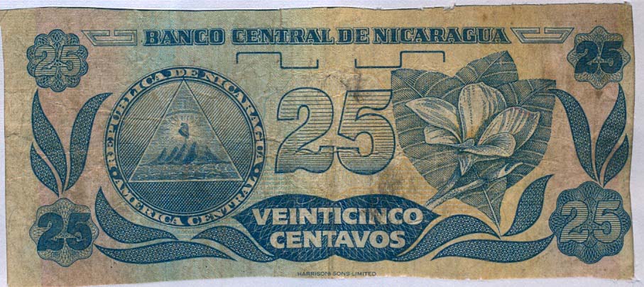
The Chief and the Conquistador: A 27-Cent Deal of a Different Kind
The only major indigenous encounter from the conquest that was deeply recorded in the history books is the legendary meeting of the famous Chief Niqueragua (Nicarao) and the Spanish conquistador Gil González Dávila on April 12, 1523.
It was one of the most lopsided business deals in history. In exchange for a basic linen shirt, a red hat, and a silk jacket, the Spanish explorer walked away with a staggering 18,506 gold pesos from the Chief. While Niqueragua was highly suspicious of these bearded strangers, he wasn't hostile. He certainly got the short end of the stick financially, but he was intelligent and clever enough to receive the Spaniards peacefully—perhaps driven by pure curiosity.​

Picture
A Week of Ancient Philosophy
What happened next was unprecedented. Instead of immediate warfare, Chief Niqueragua spent an entire week locked in deep, intellectual debates with Gil González. Through interpreters, this indigenous leader questioned and debated the Spaniard on advanced subjects like geology, astronomy, and Christian theology. He wanted to know how the stars moved, where the world ended, and why the Spanish God required so much gold.
However, Gil González was about to find out that not all tribes were willing to sit down for a chat. As he marched further north, he crossed into Chorotega territory and clashed with Chief Diriangén—a fierce leader who had absolutely zero interest in red hats, trade deals, or peaceful compliance, and instead greeted the invaders with total warfare.

Las Huellas de Acahualinca
(The Footprints of the Land of Sunflowers)

Managua 2002: Walking with Ghosts at Huellas de Acahualinca
During one of my very first trips in 2002, I tracked down the origin of Nicaragua's human history at the Huellas de Acahualinca in Managua.
Seeing these ancient fossilized footprints of men, women, and children in person is completely surreal. They were left behind around 4,000 to 6,000 BC when a group of about ten people stepped into fresh, wet volcanic mud.
For decades, the popular story was that they were frantically fleeing a catastrophic eruption. However, modern studies ruined that Hollywood plot: the distance between the steps proves they were walking at a perfectly normal, relaxed pace. Based on the prints, these ancient ancestors were quite short, standing at only 140 to 150 centimeters. Capturing those deeply etched steps on my analog film was the ultimate reminder that history in Nicaragua is baked right into the earth.

Choose Your Adventure: The Nicaragua Chronicles
As you can tell, my relationship with Nicaragua runs deep, and over the past two decades, I have gathered far too many wild stories, analog photographs, and personal milestones to cram them all onto a single page.
To help you navigate my 20-year journey—from my early days as an solo airline nomad to living on the remote coast with my toddler—I have broken my adventures down into distinct regional chapters. Each region represents a completely different side of this diverse country, packed with its own unique culture, landscapes, and unforgettable memories.
Pick your destination below, pack your virtual bags, and let’s hit the dirt tracks!
Picture

​Chapter 1: Isla Ometepe – The Volcanic Oasis
​Where I accidentally became the very first tourist in Mérida back in 2002, and why I returned for a peaceful 2-month deep dive in 2022. 

Isla Ometepe

Picture

​

Chapter 2: Managua – The Chaotic Heart of the Nation
Tracing ancient human footprints at the Huellas de Acahualinca in 2002 and surviving the raw, pulsating energy of Nicaragua’s unique capital city.


Managua

Picture

​
Chapter 3: Granada, Volcanoes & The Central Valley
Exploring colonial Granada, boating through the lush Isletas, navigating the smoking craters of Masaya, and taking the bumpy roads through Tipitapa.
(places: Granada, Las Isletas, Masaya, Tipitapa, Nindiri)

Granada/Masaya/Tipitapa

Picture

​
​Chapter 4: The Mighty Río San Juan – Steamships, Pirates & Paddles
The legendary transit route of William Walker and the Gold Rush, and my own insane 4-day solo canoe expedition paddling from El Castillo all the way to San Juan del Norte.
​(places: Río San Juan, Solentiname, San Carlos)


Rio San Juan

Picture

​
​Chapter 5: The Rama Indians – Guardians of the Ancient Tongue
A dedicated, deeply personal chapter about my rare expeditions in 2002 and 2003 to live among one of Nicaragua's most isolated and endangered indigenous tribes.

Rama Indians

Picture


Chapter 6: The Wild Caribbean North (RAAN)
The ultimate northern frontier: Moving to the remote coast and surviving 14 unforgettable, raw months living in the port town of Bilwi.

Miskito Indians

Picture


​Chapter 7: The Caribbean South & The Creole Coast (RAAS)
Navigating the mighty Río Escondido, exploring the Creole hub of Bluefields, soaking in the slow vibes of Pearl Lagoon, and chasing paradise on the Corn Islands.
​(places: Bluefields, El Bluff, Lagunas de Perlas, Corn Islands)

Bluefields/Laguna Perlas/Corn Island

Picture


​Chapter 8: The Rugged North & Mountain Highlands
Misty cloud forests, revolutionary history, and my 3-month stint teaching English and German in the coffee-scented mountains of Matagalpa.
(places: Peñas Blancas, Sebaco, Matagalpa, San Ramon, Chagüitillo)

Matagalpa

Picture


​
​Chapter 9: Jinotega, Estelí & San Rafael del Norte – Pine Forests and Hidden Highlands
Journeying through the misty "City of Mists" in Jinotega, touring the world-famous cigar factories of Estelí, and exploring the historic, pine-scented mountain roads of San Rafael del Norte.
​(places: Estelí, San Rafael del Norte, Jinotega)

Jinotega/Esteli/San Rafael

Picture

​
Chapter 10: The Deep Northern Highlands & Ancient Canyons
​Exploring the breathtaking depths of the Somoto Canyon and hunting down massive, spectacular pre-Columbian petroglyphs hidden in the remote village of Icalupe.
(places: Somoto, Cusmapa, Aqua Calientes, Icalupe, San Antonio, Condega)

Somoto/Icalupe

Picture


​Chapter 11: The Pacific South & Coastal Life
Our epic 4-month road trip in 2008 with my 4-year-old son, and what it was like to rent a beach apartment in the surf haven of San Juan del Sur.

(places: SJDS, Tola, Rivas)

SJDS/Rivas/SouthWest Playas

Picture

​Chapter 12: León – Art, Revolution, and Volcanic Ash
Exploring the historic rooftop of Central America's largest cathedral, diving into four unique museums, uncovering the ancient ruins of León Viejo, and sliding down the black slopes of the active Cerro Negro volcano.
(places: León, Las Salinas)

Leon

Picture

​
Chapter 13: The Colonial Northwest & Pacific Coast
Journeying through Chichigalpa, Chinandega, the historic port of Corinto, the beautiful Volcano Cosigüina, and the untamed beaches of the northern Pacific coast.
​(places: Chichigalpa, Corinto, Potosí)

Chinandegas/Chichigalpa/SouthEast Playas

Picture

​
​Chapter 14: Deep Into the Central Wilds
Tackling the remote routes through Juigalpa, Río Blanco, Mulukukú, and the historic gold-mining triangle of Las Minas.
(places: Juigalpa, Boaco, Villa Sandino, Río Blanco, Mulukuku, Las Minas)

Juigalpa/Boaco/Rio Blanco/Mulukuku

Overview Central America
Trip Gallery
Powered by Create your own unique website with customizable templates.